Elevation Contours 2000 includes 2, 10, 20, 50, and 100 ft elevation contour lines for Connecticut. This information was derived from Connecticut’s 2000 statewide LiDAR dataset by the University of Connecticut, College of Agriculture and Natural Resources, Department of Natural Resources and the Environment. These data are a Beta product intended for research and demonstration purposes.
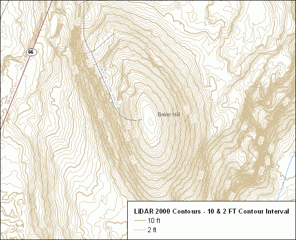
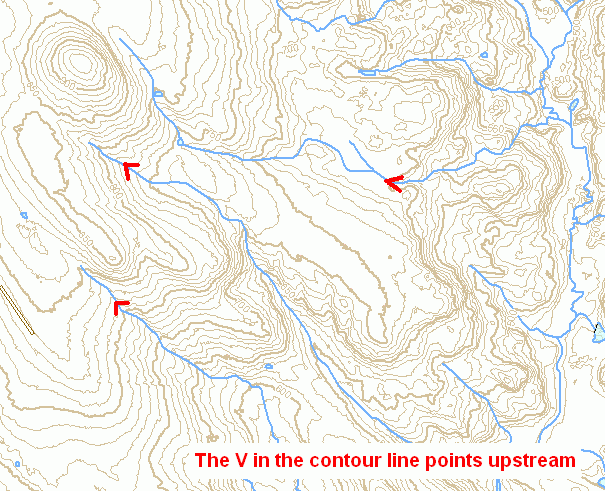
These contour lines are used to denote the elevation above sea level. From these contours a general sense of the lie of the land, terrain or relief can be determined. Terrain affects surface water flow. The direction of a stream can be determined by taking note of the shape of contour lines as they cross a stream. Contour lines are often V shaped where they cross a stream. Commonly known as the rule of V's, the V in the contour line always points upstream. Additionally, the closer contour lines are to one another the steeper the slope. In the nearby example, the west side of Baker Hill is steeper than the east side.
These contour lines are known to be incorrect in some areas. Anomalies exist due to gaps in the underlying point elevation data used to generate these particular contour lines. Areas where contours are incorrect are typically easy to identify because, in relation to nearby contours, they appear too straight and angular, do not naturally curve as expected, or don't exist where they probably should. Contours may erroneously extend into areas of open water such as reservoirs, lakes and ponds. Also, stream patterns may not correlate and follow the more accurately delineated contour lines. Due to these anomalies and inconsistencies, use caution when viewing and analyzing contour line information. Due to differences in accuracy and currentness, these contours will not always match up well with related information from other 1:24,000-scale data such as Connecticut Hydrography, Connecticut Waterbody, Connecticut Named Waterbody, and Connecticut Drainage Basins.
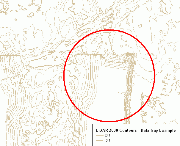
The nearby example illustrates the angular nature of incorrect contour lines. This is an area were there was a gap in the LiDAR information used by computer software to generate contour lines.
This CT ECO data guide describes contour line data for Connecticut no longer available in CT ECO. In CT ECO, it has been replaced with Connecticut Contours 2000 data.